
READ THE LAND: HOW TERRAIN, CLIMATE AND LIFE WORK TOGETHER
You pull off a forest road late in the afternoon and find what looks like an easy campsite: level ground, thick grass and a creek close enough to hear.
It also happens to sit at the bottom of a narrow drainage.
The sky is clear where you are, but the ground is littered with smooth branches, flattened grass and a line of mud several feet above the creek. Those are not random details. They are the landscape telling you that water has occupied this campsite before—and may do it again whether rain falls directly over your tent or not.
Chapter 7 of AFH 10-644, the U.S. Air Force SERE handbook, is titled “Environment.” Its lesson is broader than learning the names of mountains, trees or climates. Terrain, weather, water, plants and animals constantly affect one another. When you learn to see those relationships, a landscape stops being background scenery and starts giving you useful information.
You do not need formal geology or ecology training. You need to slow down, notice patterns and ask what caused what you see.

THE ENVIRONMENT IS A SYSTEM, NOT A COLLECTION OF PARTS
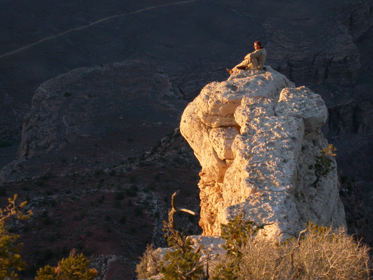
A ridge changes the wind. Wind and elevation change temperature and rainfall. Rainfall changes the plants. Plants affect which animals can live there. Water and frost break down the ridge, and the pieces eventually change the route beneath your feet.
That chain is the heart of the chapter.
For a civilian outdoors, these connections answer practical questions. Where is the safer place to camp? Which route will be slower than it appears on the map? Where might water collect? Why is one side of the mountain green while the other is brown? What does a sudden change in vegetation say about soil, moisture or elevation?
The first rule is simple: never judge a site from one feature alone.
Flat ground sounds good until you notice it is a floodplain. Dense trees offer shade until you see dead limbs overhead. A ridgeline offers an easy bearing but exposes you to wind and lightning. A creek provides water, yet its banks may be cold, damp, insect-heavy, and vulnerable to fast rises.
Every advantage comes with a bill. Read the whole site before you agree to pay it.
START WITH THE SHAPE OF THE GROUND
Terrain controls how you move and often hints at what you will encounter next. You do not need a technical label for every feature, but you should recognize four broad patterns.
Ridges and mountains
High ground gives you visibility and can simplify navigation. It can also mean stronger wind, thinner vegetation, more exposure to sun and weather, and fewer dependable water sources. Steep slopes make distance expensive: a mile on the map with ridges and mountains may take far longer than a mile on a level trail.
Ridges shed water. Small channels run downhill into larger drainages, so descending generally takes you toward collected water. That is useful, but “downhill” is not always “easier.” Cliffs, brush, loose rock and waterfalls commonly hide inside drainages.
Valleys and drainages
Valleys collect things: water, soil, vegetation, animal traffic and cold air. They may offer gentler travel and natural handrails for navigation. They can also funnel wind, hold fog and become dangerously cold overnight as dense cool air settles into low ground.
A dry wash is still a watercourse. Rounded stones, undercut banks, debris caught in shrubs and several distinct mud lines tell you that water moves through it. A storm miles upstream can turn a dry channel into a flood before rain reaches you.

Plateaus and open country
A plateau can look wonderfully straightforward. The top may be open, relatively level and easy to cross. The edges are the problem. Canyons can divide apparently continuous ground, and a route that looks direct may require a long detour to find a safe descent.
Open ground also removes protection. Expect more wind, greater sun exposure and fewer sheltered places. Before committing, identify where you can leave the high ground if weather changes.
Water, ice and shorelines
Waterways are excellent navigation features because they are difficult to misplace. They are not automatically travel routes. Banks may be thick with brush, marshy or cut by side channels. Ice is terrain too, and its appearance does not prove its strength. Moving water, springs, changing temperatures and snow cover can weaken it invisibly.
Treat a river crossing or frozen surface as its own decision, not merely another step in the route.
LOOK FOR THE WORK WATER HAS ALREADY DONE
Climate writes on the ground through erosion. Heavy rain, melting snow and rivers carry soil and rock downhill. Over time they cut channels, widen valleys and sort material by size. Fast water can move surprisingly large objects; slower water drops what it can no longer carry.
You can read that work in miniature. Fine silt on leaves marks a previous water level. Gravel bars show where a current slows or changes direction. Freshly exposed roots indicate a bank being eaten away. Driftwood lodged well above normal flow is a warning, not firewood conveniently delivered to your campsite.
Glaciers leave a larger signature. A river usually cuts a narrow V-shaped valley. Moving ice grinds and plucks rock across a much wider path, often producing a broad U-shaped valley with steep walls. Even after the ice retreats, the valley shape remains.

Wind does similar work in dry places. It removes loose fine material and drives sand against exposed surfaces. Dunes, wind-polished rock and vegetation growing only in protected pockets show the prevailing direction and strength of that process.
Frost is another slow tool. Water enters a crack, freezes, expands and pries the rock apart. Repeated cycles produce loose angular fragments that collect below cliffs as scree or talus. A talus slope may offer a visible route, but every step can slide. Rockfall from above is part of the same active process.

TERRAIN MAKES ITS OWN LOCAL WEATHER
A regional forecast may be accurate and still fail to describe the conditions on your particular slope.
Elevation is the obvious reason. Air generally cools as it rises, so a warm trailhead does not promise a warm ridge. Higher ground also meets stronger wind and can enter cloud while the valley remains clear.
Mountains force moving air upward. As moist air rises, it expands and cools. Water vapor condenses, clouds form and precipitation becomes more likely on the windward side. Once that air crosses the crest, it descends, warms and dries. The result is a rain shadow: a wetter slope facing the incoming air and a drier landscape behind the range.

The direction a slope faces matters too. In the Northern Hemisphere, south-facing slopes usually receive more direct sun and tend to be warmer and drier. North-facing slopes often hold moisture and snow longer. The difference can be obvious in the vegetation, or subtle enough to reveal itself as ice lingering on one side of the trail.
That difference can guide small decisions. In cool weather, a sunny bench may offer a warmer rest stop and drier fuel. In summer heat, the shaded side of a canyon may reduce water loss and strain. Neither choice is always correct. The point is to recognize that two spots separated by a few hundred yards can create very different demands on your body and equipment.
Large bodies of water moderate temperature because water heats and cools more slowly than land. Coastal areas often have smaller temperature swings and more available moisture. Farther inland, summers may be hotter, winters colder and day-to-night changes sharper.
Then there are microclimates: small pockets with conditions different from the surrounding area. A shaded hollow, sun-baked rock face, stream bottom and windy saddle can all feel like different seasons within a short walk.
PLANTS ARE ENVIRONMENTAL EVIDENCE
Vegetation is a record of moisture, temperature, soil, elevation and disturbance. You do not need to identify every species to use it.
Start with boundaries. If a green strip crosses otherwise dry country, water may be close to the surface or flow there seasonally. If trees suddenly become shorter and more widely spaced as you climb, conditions are becoming colder, windier or less favorable. If lush growth fills one side of a valley while the other is sparse, sunlight and moisture are probably being distributed differently.

Wet environments commonly support dense vegetation, but dense does not mean easy. Young growth after fire, flood, logging or storm damage can create a wall of stems and vines. What looks green and inviting from a distance may be exhausting to cross.
Dry-country plants advertise a different problem. Waxy or hairy surfaces, small leaves, thorns, water-storing tissue and wide shallow root systems help plants hold or capture scarce moisture. They also tell you not to expect dependable surface water merely because vegetation is present.

Use plants as clues, not as a menu. Never eat a wild plant based on resemblance, a phone image or a single identifying feature. Misidentification can turn an inconvenience into a medical emergency.
ANIMAL SIGNS TELL YOU WHO USES THE LAND—AND WHEN
Animals choose routes for the same basic reasons people do: water, food, cover and efficient movement. Tracks converging on a creek, worn paths through brush, droppings, browsed plants and feathers can reveal where those needs overlap.
Signs of animal tracks are most useful when you read its age and context. A sharp track in damp mud is newer than one with crumbling edges. Droppings darken and dry with time. Spiderwebs across a trail suggest nothing large passed recently. One print tells you an animal was there; repeated fresh signs of animal tracks tells you that the place is being used currently, and most likely often.

Behavior changes with climate. In hot, dry areas, many animals avoid the day by burrowing or moving after dark. In cold regions, activity may concentrate around sheltered ground, exposed food or seasonal migration routes. Silence at noon does not mean a desert is empty; it may mean you arrived during everybody else’s sensible rest period.
Animal trails can suggest water is nearby or possibly an easier passage, but they are not built to human standards. They may squeeze under brush, cross steep slopes or end at a den they tend to call home. Large-animal tracks mean that large animals may be nearby. Observe it without following blindly, and store food and waste according to local wildlife rules.
MAKE TIME FOR A TEN-MINUTE ENVIRONMENTAL READ
Before choosing a campsite, leaving a road or committing to unfamiliar terrain, stop for ten minutes. The pause is short enough to be practical and long enough to notice what a quick glance misses.
First, read the shape. Identify the high ground, low ground, drainages, steep faces and possible exit routes. Ask where water would travel if heavy rain began upstream.
Second, read the surface. Look for mud lines, loose rock, undercut banks, deadfall, burned ground, ice, deep sand or fresh erosion. These are conditions, not scenery.
Third, read the exposure. Consider sun, shade, wind and elevation. Will this comfortable afternoon site become a cold-air basin after dark? Will that protected hollow become a drainage path during a storm?
Fourth, read the life. Notice vegetation changes, insects, tracks, droppings and trails. They can point toward water and shelter, but may also warn of thick travel, biting insects or wildlife traffic.
Finally, compare your observations with outside information. Check the current forecast, topographic map, fire restrictions, flood watches, tide tables or park alerts that apply. Your eyes can explain the ground that is immediately around you. Maps and official warnings reveal hazards beyond what you can see.
THREE ORDINARY DECISIONS THAT THIS SKILL IMPROVES
Choosing camp: The lowest, flattest spot beside water is easy but often damp and exposed to flooding. A better site may sit slightly above the drainage, outside visible high-water marks, away from dead limbs and with a route for exfiltration in more than one direction.
Choosing a route: A straight line across contour lines may hide exhausting elevation changes. A drainage path may simplify navigation, but can also contain cliffs and thick brush. The better route balances distance, slope, stable footing, water, exposure and a realistic turnaround point should things go awry.
Dealing with a disabled vehicle: Before walking for help, read the larger setting. Roads usually connect somewhere, while cross-country shortcuts can hide canyons and private boundaries. In many situations the vehicle is easier for rescuers to see and provides shelter and supplies. Leaving it should be a deliberate decision supported by a known route, not impatience.
This is why environmental awareness belongs beside equipment. A FIELD//MOD module can help solve a problem, but reading the land may keep you from placing yourself in the problem’s path. The most valuable thing that observation buys is time: this includes time to move your camp and belongings, time to change your navigation course, add a layer of clothing or protection, or decide that today is not the day for that crossing.
YOU ARE NOT TRYING TO NAME EVERYTHING
The goal is not to identify every rock, plant and track. It is to recognize cause and effect.
Water leaves marks. Wind shapes exposed ground. Frost loosens slopes. Mountains change rain. Vegetation reveals moisture and temperature. Animals connect food, cover and water with repeated routes.
Look for several clues that agree. A single green patch may mean little. A green corridor in a drainage path, converging tracks and damp soil tells a stronger story. One branch on the bank may be ordinary. Debris caught throughout the brush above your head says the creek has another personality. (One you may not like!)
Read the terrain before you ask it for anything.
The land usually tells you what it can provide—and what it can take away—well before the lesson becomes expensive.
FURTHER READING AND FIELD REFERENCES
AFH 10-644 — Survival, Evasion, Resistance and Escape Operations
Chapter 7 is the foundation for this article’s discussion of terrain, life forms, climate and the connections among them.
USGS Water Science School
Clear explanations of streams, groundwater, runoff, erosion and the water cycle.
National Park Service — Geology
Beginner-friendly material on landforms, geologic processes and the landscapes protected within national parks.
National Weather Service — Flood Safety
Official guidance for recognizing flood risk and responding to watches and warnings.
USGS Topographic Maps
Maps and learning resources for seeing elevation, slopes, ridges, valleys and drainage patterns before entering the field.
Share:
Weather Without a Forecast: A Field Guide to Clouds
The Environment Decides What Comes First